“Downtown” Uranium City

A former booming mining town (1950’s – 1982) with an active and busy downtown.  With the announcement of the closure of the mine and mill in 1981, the economy collapsed. Businesses closed their doors, and the residents left.   The story goes- ‘If you leave your keys (to the company house) then you get a free flight out of town’.  Whether or not this is true – many residents left with minimal luggage, leaving behind their furniture, clothes, extra sporting equipment, even their vehicles.  Some residents actually thought they would return, leaving their house keys with those that remained. Supposedly, there is a wall of keys, but I didn’t see it.  

In 1983 Uranium City lost its status as a town and became an unincorporated “northern settlement “. At some point, the decision was made to abandon municipal services to the outlying parts of town, and all properties were reverted to the hamlet.  All property, including structures and personal property from the previous occupants became ‘fare game’ to the remaining residents.  During the past 42 years since the mine closed, almost everything of interest or value has been salvaged for re-use, or simply destroyed. The CANDU High school was closed in 1983. The roof has collapsed and everything inside and out has been literally trashed. In 2003 the hospital closed and was demolished.  The former RCMP building converted into – Post Office, Municipal building and Health Clinic. There is a boil water advisory (and has been for a long time), a drinking water bottling station is currently being set up. 

Former RCMP, now Uranium City Post Office, Administration and Health Clinic.


“Downtown” Uranium City.  Streets were at one time paved (using mine tailing) are now mostly dirt, and remnants of sidewalks are occasionally visible through the shrubs and bushes. There are no street signs to mark the at-the-time aptly named streets;  ‘Fission Avenue’, ‘Nuclear Avenue’, ‘Uranium Road’, and ‘Edorado Street’.   These streets are now bordered by empty lots, concrete foundations, concrete steps leading to a non-existant doorways, or a boarded-up and dilapidated building. Most of the boarded-up buildings in the ‘downtown’ area are privately owned, though they are not likely to be repaired, or re-used. 

Foundation and stairs leading to a non-existant doorway.


Maps of Uranium City properties and streets.  Most of the properties shown on map at left are abandoned. ‘Downtown’ Uranium City and the area still connected to municipal services are shown on the map on the right.  However, the vast majority of the properties are empty. 


There is one gas station and store – Parkes General Store, selling groceries, clothing, tools and souvenirs.   There isn’t much tourism. Most visitors to Uranium City are geologists working on nearby mineral claims, and crews conducting maintenance on the power lines that line Uranium City to the power station near Camsell Portage. There are however another group of visitors – those that come to see and photograph the “ghost town”, the entire suburbs of abandoned houses, the school and the collection of signs removed from building that were scheduled to be town town.   


Signs that once hung on (now destroyed) buildings in Uranium City.


Sign for Uranium City Hotel (long gone).


Former Legion Hall

Former Hardware store


Liquor store, then grocery store – now abandoned.


Gallery of assorted structures in Uranium City

Aerial view. Uranium City lies within the area of the deciduous trees. ‘Downtown’ is in the distance.


Uranium City Houses

Pictures of Uranium City on social media only include houses in the abandoned part of town; houses that have collapsed or have been stripped of usable materials – the empty hulks of a formerly lively house. I also photographed these houses, it is an unusual sight and photographically interesting.

But – what houses do the 70 habitants of Uranium City live in ?. These photos are a cross section of those houses, some resemble those in a typical Canadian town; vegetable gardens, potted flowers, trimmed grass, neatly stacked firewood, motor boats and trailers in the driveway. 


CANDU High School in Uranium City, Saskatchewan

Grad 1981. They were the last graduates of the CANDU High School, in Uranium City. The CANDU high school, open in 1979 and named the “best equipped high school “ in Northern Canada. On December 3rd, 1981 Eldorado Nuclear announced it would close the 30-year old mine and mill on June 30, 1982. Businesses closed and the population left. From a pre-closure population of 2,507 in 1981 to less than 800 in 1983. The CANDU school was closed and abandoned in 1983 with less than one-tenth of the students remaining. In 1982 the grade 10 class created a booklet The history of Uranium City and District – “With the closing of the last operating mine in the area Uranium City faced the imminent danger of becoming a ghost town “. The term “ghost town “ is still being used to describe Uranium City. 


Steve Schwarz Photography | Uranium City treasure

Uranium City treasure

Uranium City treasure. Door from a Eldorado Mining and Refining Limited (EM&R) truck. Due to the importance of Uranium during World War 2, the Canadian Government nationalized Eldorado to supply the United States military with uranium products. This truck probably worked at the Beaverlodge Mine (Eldorado Mine) uranium mine in the community of Eldorado, approximately 7 kilometres (4.3 mi) east of Uranium City, Saskatchewan. Beaverlodge Mine opened in 1953 and closed in 1982. Any know the make and model year of this truck?.


RCAF / ARC Snowbirds

A couple of pictures of the RCAF / ARC Snowbirds doing their stuff over Yellowknife (July 13, 2024). Photos taken from the roof of my house. Click on the picture of see an enlarged  version.


Instagram post of a plastic model and a watercolour painting of a Snowbird airplane.  (Actually ‘Liked” by Snowbird#6 pilot).


Flight: Inuvik to Ivvavik National Park

Ivvavik National Park is a Canadian National Park located in the northern Yukon Territory.The park was created as part of the Inuvialuit Final Agreement in 1984, between the Government of Canada and  the Inuvialuit, to protect and preserve the calving ground for Porcupine caribou. A small family run gold mining operation operted at Sheep Creek until they were evicted as part of the Inuvialuit Final Agreement.


These photos were taken on June 24, 2021 on a chartered Twin Otter from Inuvik. Click on the picture to make it bigger, and click on the ‘Next’ arrow to view the next photo. More pictures will be posted later. 


Steveschwarzphoto – Instagram Feed

View my Instagram feed here: 

If you have any questions, or comments – drop me a line. 

Road Trip: Edmonton to Nevada & Utah

We picked up my passport and truck (1991 Toyota Landcruiser FJ80) in Edmonton, and headed south.   November 23 – December 6th. Pictures taken with a Leica M240 with Leica -R 19mm lens, Nikon D700 with Nikkor 17-35mm lens. Photos processed in Lightroom. If you have any questions, or comments – drop me a  message. 


Bernadette – finishing off a pair of socks while i waited in line at Service Canada for 10 hours to pick up my new passport.


Short visit to the Landcaster Museum in Nanton, Alberta. Check out that ancient Avro CF-100 ‘Clunk’ jet, and the equally ancient Landcruiser !


Montana

We simply ‘passed through’ Montana. Road pictures only. Photo gallery below.  


Hurricane Mesa (Virgin, UT)

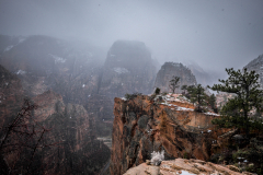
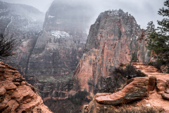
In Virgin Utah, we drove up Hurricane Mesa for un-impeded views of Zion National Park, and drove across the Mesa to the entrance to Zion National Park. Awe-inspiring views of the coloured sedimentary rocks. Photo gallery below. 


Logandale Trails (Logandale, NV)

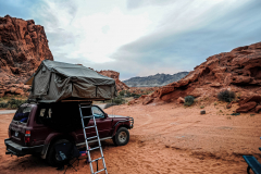
At Logandale we entered the ‘Logandale Trails’ off-road area. Intended primarily for quads and side-by sides.  The roads were no problem for our Landcruiser.  Again, more red-coloured rocks, although tilted. To the east, on the horizon, perfectly horizontal layers of sedimentary rocks. We passed the parking lot full of campers and RV’s, and empty trailers for off-road vehicles and had the area to ourselves. We camped here for 2 nights, and had a little fun making shadows of ourselves with the truck headlights. Photo gallery below. 

Valley of Fire State Park (Moapa Valley, NV)

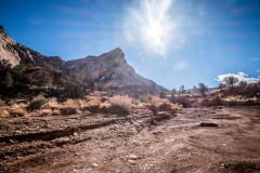
Valley of Fire is characterized by layers of bright red sandstone and grey limestone. The sandstone was deposited during the Jurassic period (201.3 million to 145 million years ago), by the wind after inland seas subsided and the land rose. Photographically the conditions were challenging – bright sun and no clouds, as such the photos appear over contrasty. we did an early morning walk – but got in trouble from the Park Ranger because we were walking on the road (not a vehicle to be seen for miles !).  Yes, the rumour it true – I did knit myself a scarf !.   Photo gallery below. 


Flickr – Steveschwarzphotography on Flickr

These photo were posted on my Flickr account (SteveSchwarzPhotography). I no longer upload to this account. The photos below link directly to the Flickr account. If you have any questions, or comments about  these photos – drop me aline, 


Canoe Camping

Getty Images (These photos have been licensed to Getty Images)

Northern Science – Remote Sensing

NWT

Sailing – Great Slave Lake

Kite Skiing: In-Action Photography

Most Commonly Viewed Images

Flying over Yellowknife Area

Airplanes

B-29 “Kee Bird” near Thule Greenland

Aurora – Northern Lights Yellowknife

Navy – 1987

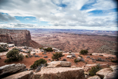
Zion, Capitol Reef, Canyonlands and Arches National Park (Color)

A typical photospread. No need to add much text, as there are are plenty of more wordy places to learn about Zion, Canyonlands and Arches National Park.  I didn’t even include a map (seems odd for a guy that makes maps for a living).

Cameras used; Leica M240 with Leica-R 19mm, and Fuji X-Ti with Fujinon 14mm


Zion National Park

Capitol Reef National Park

Canyonlands National Park

Arches National Park